Just an hour's drive from Melbourne lies an adventure perfect for aspiring hikers: the Two Bays Walking Trail. This 27km journey across the Mornington Peninsula became my gateway into the world of overnight hiking – a challenge I decided to tackle with more enthusiasm than experience.
The Two Bays Walking Trail begins from Dromana foreshore, climbing Arthurs Seat before winding through the diverse landscapes of various parks and a few quiet roads to end at the Cape Schanck lighthouse, having crossed the peninsula to link the contrasting shores of Port Phillip Bay and Westernport Bay. Having wanted to try overnight hiking for a while, I recently decided to just give it a go.
I had not done an overnight hike before, so the short and accessible trail would serve as an excellent beginner's introduction to overnight hiking. There is a walk-in campsite at Lightwood Creek part way along the trail where I would spend the night. There is no public transport or phone reception at the Cape Shank end of the trail, so transport from there must be organised in advance. Due to minimal advanced planning, I decided to return to Dromana on the second day.
Having recently acquired a hiking pack and a compact sleeping bag, I managed to stuff all my gear into it, making sure to bring all the water that I would need as there are no sources of drinking water along the trail. I then caught the 788 bus, which goes from Frankston train station right to the start of the trail, arriving around midday, excited to start my hike.
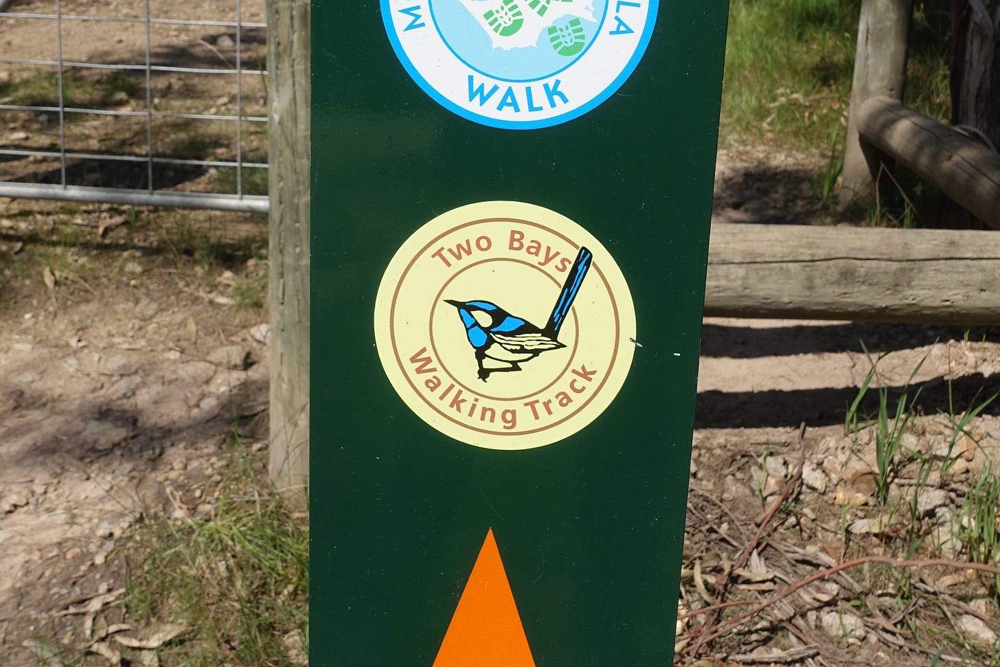
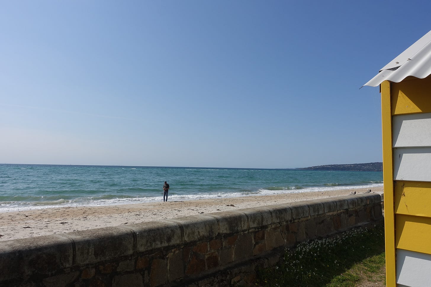
The trail starts from the foreshore by a conveniently located toilet block and begins with some steps through the Latrobe Reserve Scenic Walkway, then continues uphill before entering the base of Arthurs Seat State Park. A Trail Map can be found on the Parks Victoria website or at the Dromana visitor information centre, with the route being fairly well marked by signs featuring a distinctive Blue Wren symbol.
Being early spring, the weather as I started my hike was lovely. Sunny and warm, but not too hot, with the forecast for the next two days being perfect. I had an 18 kg pack on my back and a large hill to climb, but I was feeling good and looking forward to the experience.
Arthurs Seat State Park
I found the walk up the steps from the foreshore, past Latrobe Parade Carpark (a popular overnight parking spot for those driving to the trail) and then along the steep path up Arthurs Seat to be a bit tricky, but it was over quicker than I expected. I was planning to have my lunch once I reached the top, but the climb had only taken 45 minutes so I was not yet hungry. Before long, I reached the turnoff that lead to Seawinds Gardens and the summit of Arthurs Seat. The short walk from the trail to Seawinds Gardens is pleasant, with a nice picnic area available, but as I had visited the summit only a few weeks prior I felt no great need to explore the area again.
On my previous expedition, I had walked up Arthurs seat with a heavy backpack to get an idea of the difficulty of the initial ascent, finding that while it was a bit steep, it was not too hard and not too far. This reconnaissance trip, which included exploring the short Summit Circuit Walk, is part of what lead me to just go for it and actually attempt the Two Bays Trail as my first overnight hike.
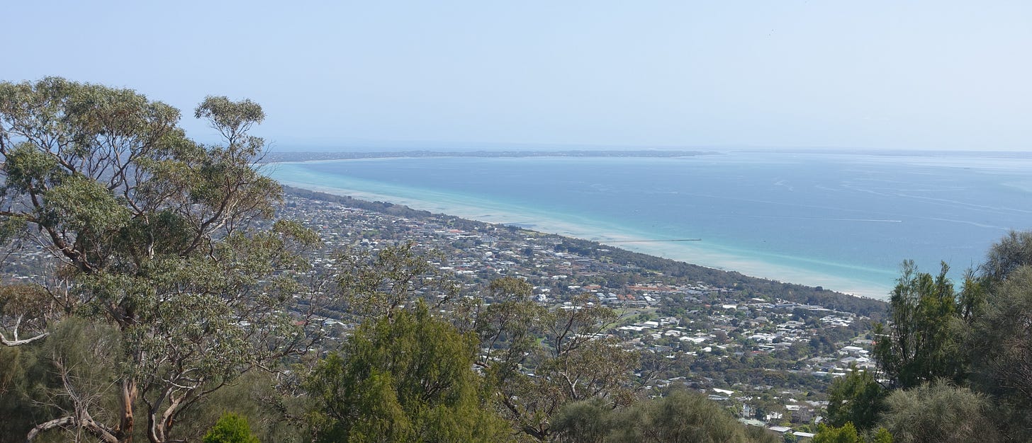
Having decided not to detour, I continued along the trail towards the other side of the peninsula. By climbing Arthurs seat, I had conquered the hardest part of the walk, with a great view to show for it. From here on in, I hoped that it would be flatter and easier going.
As I made my way through Arthurs Seat State Park and the TC McKeller Flora Reserve, the path wound its way through a beautiful shady forest of tall trees, with the sounds of nature creating a wonderfully relaxing atmosphere. The walk through this forest was very peaceful with plenty of wildlife, including colourful birds flitting through the trees and across the path. However, it wasn't totally quiet, with some sounds of traffic from Dromana still audible and a fair few people doing shorter walks along this section of the trail.
On my previous exploration of Arthurs seat I had come across some kangaroos, but so far there were none to be found. As I made my way through the eucalypt forest, I did come across some rather old but still legible signs, that provided maps as well as interesting information about the flora of the area.
At the junction with the track to Kings Falls, I again decided not to detour, knowing that I still had a fair bit of walking ahead of me. At this point the path came out of the forest, with the area becoming a lot more open with plenty of inviting shady spots with dry grass to sit on, so I took the opportunity to stop for a little break, have a drink and check the map to make sure that I continued in the right direction.
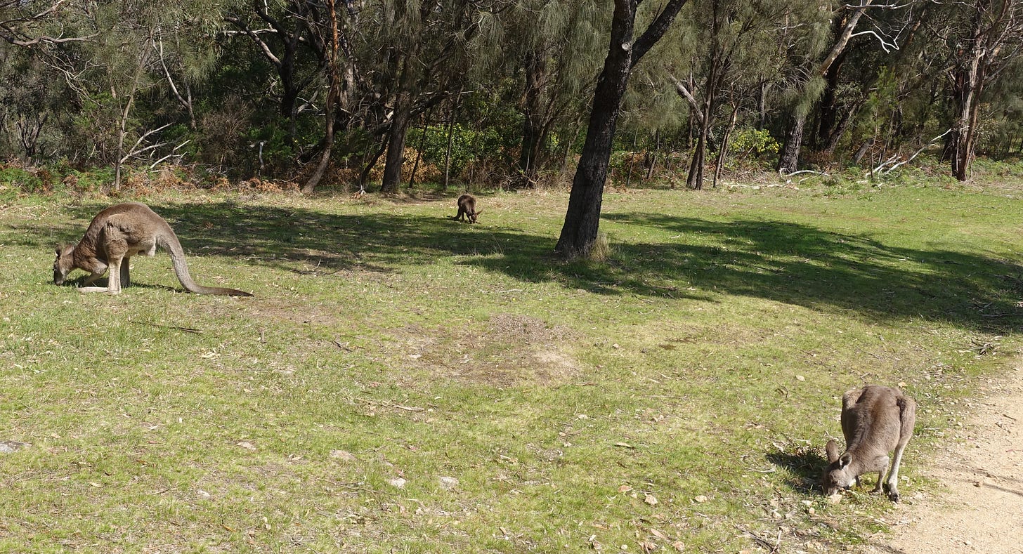
Shortly after I got back on the trail, I spotted a kangaroo bounding across the path ahead, they were out today, after all. As I continued along, I saw a whole group of kangaroos (or possibly wallabies, I can't really tell the difference) right on and next to the path, really making the hike start to feel like more of a wilderness experience, despite still being so close to the suburbs.
The next section of the trail was a bit steeper than I had imagined, but of course I did have to descend from (close to) the summit of Arthurs Seat. Luckily, climbing back up this slope would be a problem for the next day. I soon made it down the hill and to McLarens Dam, a beautiful spot where I decided to finally eat my lunch. I again avoided a detour that went around the far side of the dam, with the main trail still taking me right along one side of water. Finding a pleasant grassy spot to sit, I stopped to eat my lunch while watching the birds splash about in the dam.
I enjoyed a nice lunch by the dam, listening to bird calls and watching the occasional mountain biker cycle past. Shortly after I got going again, I came to Waterfall Gully Road, marking the end of Arthurs Seat State park. I was now just over 5 kilometres into my walk, which meant that I was about a third of the way to the campsite.
Between the Parks
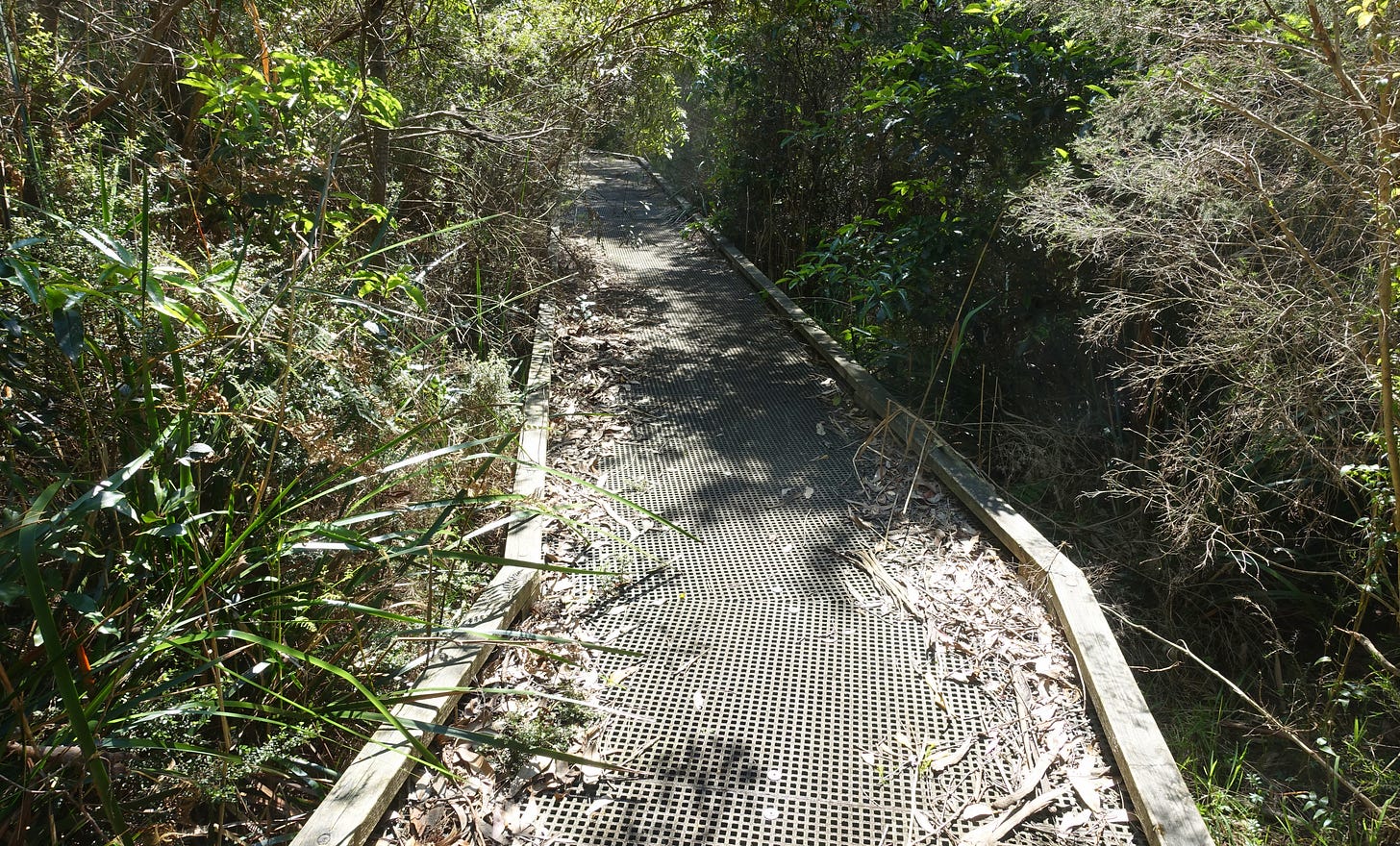
The next section of the walk went along some quiet local streets, so I made sure to break out my map and keep an eye out for the Blue Wren signs pointing the way. The residential section wasn't particularly interesting, but it was at least broken up by Goolgowie Bushland Reserve, which had a nice boardwalk that weaved through trees and ferns.
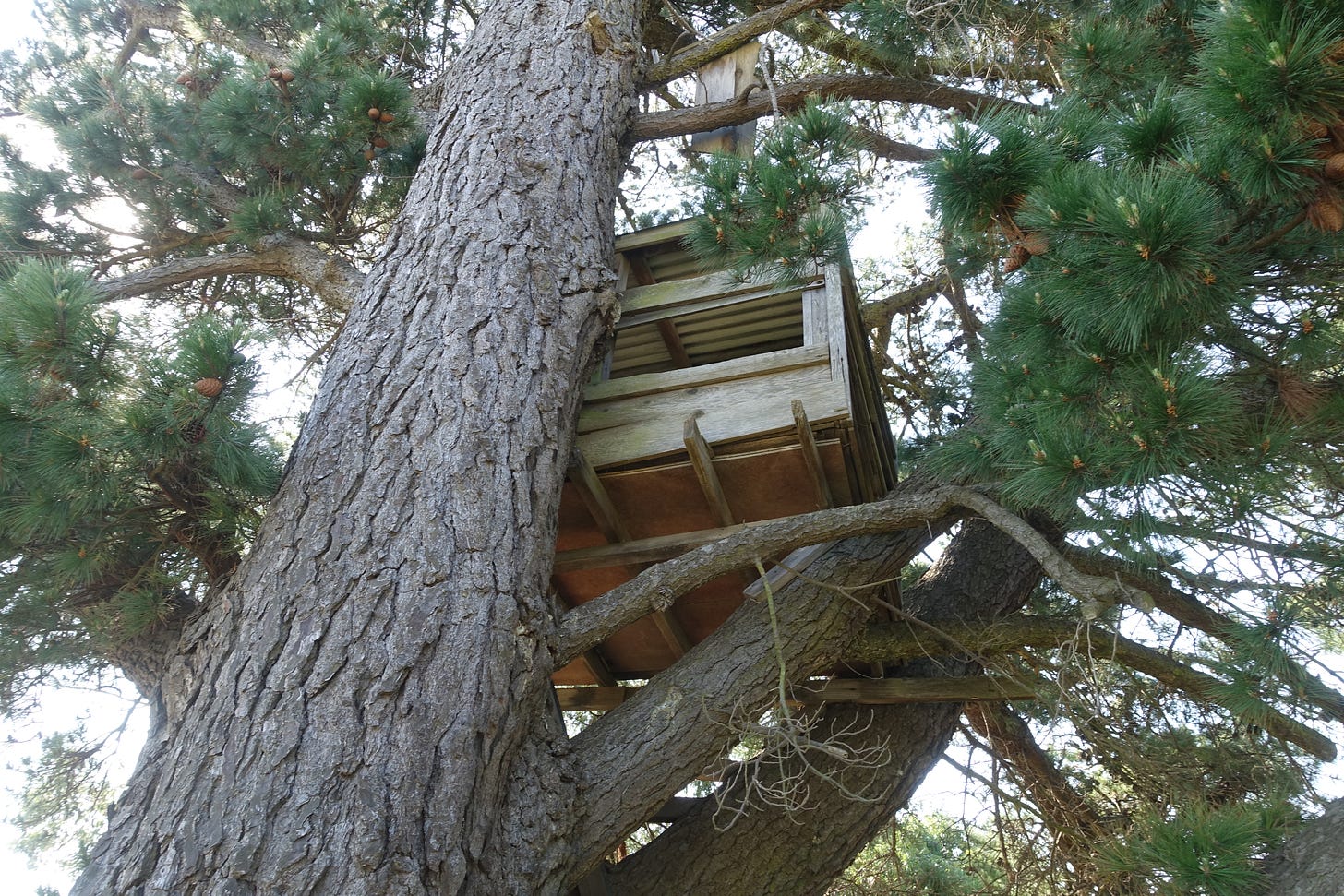
The end of the road section started to feel a bit more rural as I passed a few small vineyards and an interesting treehouse. As I came to the end of the residential section of the trail, I reached Gardens Road reserve. An informative sign told me that the reserve is actually an unused section of road, which explains why it continued in a straight line between private properties. Being unused, Gardens Road was not actually a road, but instead a pleasant grassy reserve, which I found to be worryingly downhill, worrying because I knew that I would have to come back up the same hill the next day.
The Stephanie Rennick walk through the road reserve was very enjoyable, with fun little bridges crossing babbling streams. There was a small muddy section, where I managed to get my (falling apart) shoes a bit damp, but it was totally passable, although I am unsure how muddy it would be on a wetter day. As I continued on, the road reserve became increasingly forested and I started to feel a lot more like I was alone in nature, with all the day walkers having disappeared after I left Arthurs Seat State Park.
After completing the Stephanie Rennick walk through Gardens Road Reserve I reached Browns Road, where I stopped for a quick break. I then trekked down the gravel Hyslops Road for a couple of kilometres, which while not extraordinarily interesting, was at least easy going and had some birds in the trees and wildlife to listen to as I strolled along.
The gravel road eventually gave way to a welcoming grassy track that lead into Mornington Peninsula National Park. I stopped at a junction for a few minutes to rest and consult the map, before continuing along the next section of the trail. I knew that I was now over two thirds of the way through my hike, so I didn't have too much more walking to go before I would reach the campground.
Mornington Peninsula National Park
The next section of the walk was lovely, with a shady path winding through a rather open forest full of low bushes as well as eucalyptus and paperbark trees. The path was quite level and easy to follow, with plenty of Blue Wren signs making it hard to take a wrong turn. Out of all the sections of my hike so far, the section though Mornington Peninsula National Park to the campsite was the nicest. It felt very natural with lots of birds flitting through the tree branches and animals rustling the bushes as I walked past.
To give you an idea of the tranquil atmosphere, I made a short recording of the sounds of Mornington Peninsula National Park.
The trail shortly led into the area known as Greens Bush, which a sign informed me was named after the Greens family, who originally purchased the land for farming but left much of it uncleared, with it later being purchased by the state government to create a park.
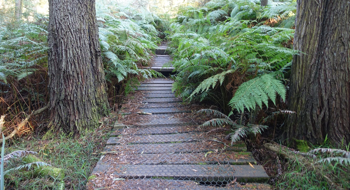
The track through Greens Bush was very pleasant and I was surrounded by nature on all sides. The trail continued along narrow paths that incorporated beautiful wooden boardwalks, some of which were almost overgrown by ferns. I hiked across rickety wooden bridges through cool ferny gullies, emerging into patches of open scrubland before plunging back into the trees, where I caught glimpses of kangaroos bounding through the undergrowth.
A slightly sandy track took me the rest of the way to Lightwood Creek camping area, where I would spend the night. I had reached my destination after a little over five hours of hiking, although that was at a fairly relaxed pace with plenty of breaks taken along the way. I was now about 16 km from where I started my walk and almost two thirds of the way along the Two Bays Trail, which meant that my plan to return the same way would be longer than doing the whole trail in one go. I found the day's hike from Dromana foreshore to Lightwood Creek to be about the right amount of walking for my first overnight hike.
Lightwood Creek Camping Area
Lightwood Creek camping area featured a drop toilet, a rainwater tank (not for drinking) and a few low tables. It was fairly busy by the time I got there, possibly because it was the first nice weather of the season and a long weekend. After selecting my site (which may not have technically been a camping site, just level ground nearby, already covered in tents) where I could find some remaining space, I set about putting up my tent. While this was my first overnight hike, I did helpfully already have most of the gear that I needed from previous (car) camping trips.
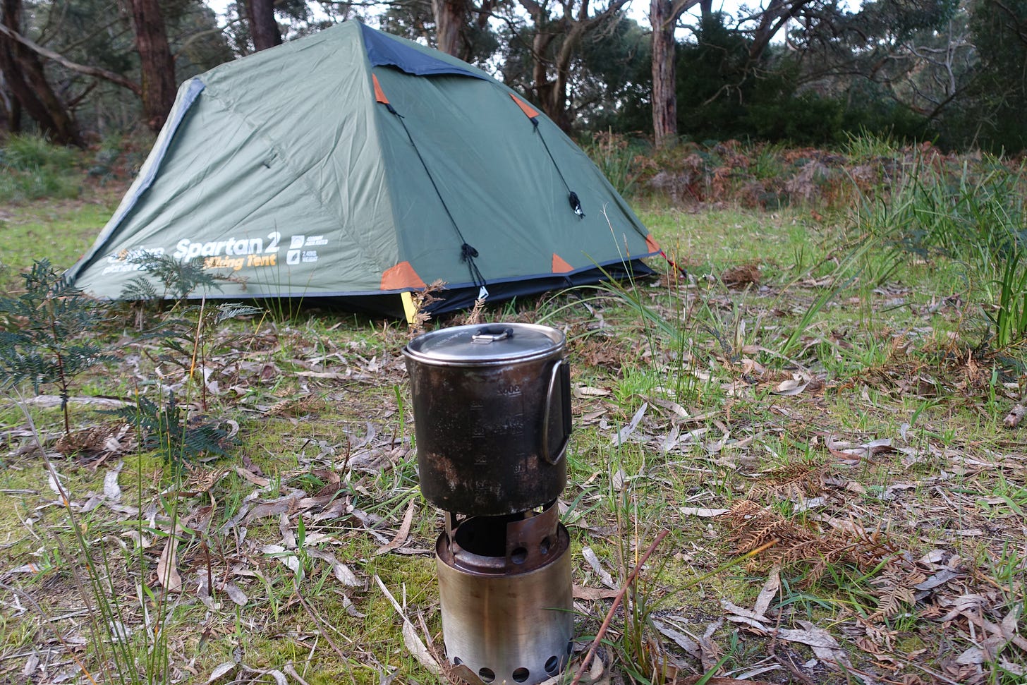
Once my tent was up and my sleeping mat inflated, I focused on making dinner as there was only about an hour of daylight left. I used a Trangia alcohol burner inside a metal Solo Stove to prepare my meal, as hot food is so much nicer after a hard day's hiking. The cooking was easy, because I was simply boiling water for my not exactly gourmet meal of instant noodles and tuna, along with a cup of tea. The food did its job, filling me up, with the cooking experience itself being quite relaxing with my slow alcohol burner.
While I was eating my dinner, I was approached by a camper from a neighbouring tent. They explained that they were also on their first overnight hike and had unfortunately forgotten the gas bottle for their stove, asking me to boil a pot of water for them. I was happy to oblige and luckily had enough fuel left for my stove. We enjoyed a nice conversation while their water was boiling, which I think showcases the friendliness of the people you can meet when out on an adventure. The other camper seemed to think that I looked well prepared, which was nice to hear on my first overnight hike.
With my dinner finished and the sun set, it was time for me to retire to my tent. I needed to change into warmer clothes, because as the sun had set the temperature had dropped with it. I then spent a while writing down my experiences for this blog post while listening to koalas grunt in the nearby trees. I left my tent once more before bed, which gave me the opportunity to admire the many pretty stars in the very clear sky overhead. Eventually, it was time to climb into my sleeping bag and go to bed. I was ready for sleep after walking over 27,000 steps since breakfast.
Waking Up on the Trail
I woke up in my tent after an unsettled night which had been a little chilly, with the temperature having dropped below five degrees. I had been awoken in the night by my sore legs, but thankfully I had some painkillers with me in my first aid kit, which allowed me to get back to sleep. My day began with packing up my sleeping gear and changing out of my night clothes, before exiting my tent to have breakfast. Somehow, I still had a little fuel left for my stove, so I was able to boil water for a refreshing cup of tea to drink with my granola.
After breakfast it was time to pack up my tent and shove everything back into my hiking bag. I had a long walk ahead, heading all the way back to Dromana due to the lack of public transport at the Cape Shank end of the Two Bays Trail. With the return journey being essentially just the reverse of what I did the previous day, I have not documented my trip back in quite as much detail.
Once I was all packed and finished at the campsite, it was almost ten o'clock, so time to get going. The sun was shining and my hiking pack was noticeably lighter than when I set off the previous day, due to now containing less water and food, so I was in high spirits and looking forward to the day's wanderings.
Lightwood Creek to Dromana
I hiked back through the beautiful shady forest and open scrubland of Greens Bush, listening to chattering birds and leaves rustling in the wind. I was surprised by a snake on the path ahead, but thankfully it slithered off before I approached. My next encounter was a group of bird watchers who were staring into the trees.
After coming out of Greens Bush and walking through the last part of Mornington Peninsula National Park, I stopped for a quick break having already completed about a third of my return hike. I needed to take off my coat with the weather warming up and have a drink, I also took the opportunity to make use of the phone reception now that I was back in range.
I then returned straight down the gravel Hyslops Road, crossing Browns Road before heading back along the Stephanie Rennick walk through Gardens Road reserve. The muddy patch was only marginally drier than the previous day, although this time I managed to avoid soaking my shoes. Upon encountering the hill that had worried me the previous day, I found it to be not quite as bad as I had feared, although I did still require a short rest at the top.
Having reached the Rosebud South section of the Two Bays Walking Trail, I walked back along the local streets, including past the treehouse and through Goolgowie Bushland Reserve. The street section didn't seem to take as long on the way back, perhaps because I knew the way, so didn't have to keep stopping to check the map. The trail so far had seemed a bit busier than the previous day, perhaps because it was now the weekend, perhaps because it was earlier in the day.
I soon reached Waterfall Gully Road and the entrance to Arthurs Seat State Park. The walk certainly seemed like easier going than the previous day, thanks to the reduced weight of my pack. This time I didn't stop and rest by McLarens dam, instead getting straight into tackling the steep slope leading up Arthurs Seat. I again avoided detouring around the dam (or to Kings Falls), knowing that the track back to Dromana foreshore would be (more than) enough walking for one day.
Once I reached the top of the slope, which although steep was not as difficult as the previous day's initial ascent, I had a quick rest before making the pleasant but rather hilly stroll towards Seawinds Gardens and the summit of Arthurs Seat. Unfortunately, I didn't see any more kangaroos on my return journey through Arthurs Seat State Park. I did pass a few people starting their own hike along the Two Bays Trail, answering a question about the busyness of the campsite. As I told the hikers, it was rather busy, but they would be able to squeeze in somewhere.
This time I did take the turnoff into Seawinds Gardens, making the very short detour to find all the picnic benches already occupied. This was fine, as I simply chose a nice spot on the grassy lawn to enjoy my lunch in the pretty park, being mindful not to sit on any kangaroo droppings.
Downhill to the Foreshore
After a relaxing lunch, I only had to walk back down Arthurs Seat to Latrobe parade, a task that was fair easier than going upwards, although I still had to be careful not to slip. I then left Arthurs Seat State Park and made my way down the last little section of the trail to Dromana Foreshore, reaching the end of the trail at around half past two. It had taken me four and a half hours and another 25,000 steps, but I had managed to complete the return hike a bit faster by setting a slightly quicker pace and taking fewer breaks. One thing to remember about overnight hiking is that your backpack is only going to get lighter (mine was only 13 kg when I got home), making the start the hardest part.
I found my bus stop right by the end of the walk, making it easy to catch a bus back home. I did have to wait half an hour for the next bus, but was happy to rest (and write up my wanderings for this blog post) after walking another 18 kilometres. I had successfully completed and enjoyed my first overnight hike on the Two Bays Trail, having benefited from great weather the whole time, making full use of the first warm and sunny weekend of the season.
My advice for anyone else wanting to try out overnight hiking? Just go for it. You will make mistakes but that is part of the journey. As long as you keep putting one foot in the other, you will eventually reach your destination. I would definitely recommend the Two Bays Trail for a beginner's first overnight hike.
Wander Map
Have a look at where I wandered on this interactive map.






What a really cool adventure. Thanks for sharing.